| dc.contributor.author | Goodwin, Katherine R. | |
| dc.date.accessioned | 2016-06-10T01:01:07Z | |
| dc.date.available | 2016-06-10T01:01:07Z | |
| dc.date.issued | 2002 | |
| dc.identifier.uri | http://hdl.handle.net/10106/25712 | |
| dc.description | October 4, 2002 - January 15, 2003 | en_US |
| dc.description.sponsorship | Center for Greater Southwestern Studies and the History of Cartography, UTA * Philip Lee Phillips Society * Special Collections, UTA Libraries * Texas Map Society; Virginia Garrett Cartographic History Library Endowment | en_US |
| dc.description.tableofcontents | Introduction (4) - Exploration and Discovery (7) - Trade and Mercantile Interest (13) - Imperial Aims and Scientific Accuracy (19) - Sea Power and Political Influence (25) -- Commercial Enterprises and Coastal Surveys (31) - Spanish Contributions to New World Cartography (37) - The Greater View (43) - Selected Research Bibliography (46) | en_US |
| dc.language.iso | en_US | en_US |
| dc.publisher | Special Collections, Central Library, The University of Texas at Arlington Library | en_US |
| dc.rights | ©2002 | |
| dc.subject | Cartography | en_US |
| dc.subject | Mapmaking | en_US |
| dc.subject | New World -- Exploration -- Maps | en_US |
| dc.subject | Gulf of Mexico region --Maps | en_US |
| dc.subject | Caribbean Islands -- Maps | en_US |
| dc.subject | Maps -- Historical intereptation | en_US |
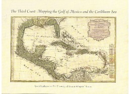
| dc.title | The Third Coast: Mapping the Gulf of Mexico and the Caribbean Sea | en_US |
| dc.type | Gallery Guide | en_US |
| dc.description.pagination | 48 pgs. | en_US |