| dc.contributor.author | Huseman, Ben W. | |
| dc.date.accessioned | 2016-06-09T22:57:00Z | |
| dc.date.available | 2016-06-09T22:57:00Z | |
| dc.date.issued | 2008 | |
| dc.identifier.uri | http://hdl.handle.net/10106/25709 | |
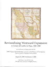
| dc.description | An Exhibition in Conjunction with the 2008 Virginia Garrett Biennial Lectures on the History of Cartography
Virginia Garrett Cartographic History Library
August 25, 2008 thru January 3,2009
Sixth Floor
Special Collections
The University of Texas at Arlington Library | en_US |
| dc.description | Dedicated to Richard Francaviglia and Dennis Reinhartz | en_US |
| dc.description.tableofcontents | International Tensions and Enlightenment Knowledge Maps of the West, circa 1800 (5) - Maps from the Louisiana Purchase Explorations, 1804-1814 (9) - Contending Neighbors in a Vast Land Maps of 1815-1844 (12) - Maps of Manifest Destiny, 1846-1848 (20) - The California Gold Rush in Maps (27) - U.S. Government- Sponsored Surveys of the 1850s (29) - The American Civil War: Maps of 1861-1865 (35) - Further Expansion in the West Maps of the 1860s and 1870s (37) - "The Closing of the Frontier" Maps of the 1880s and 1890s (43) | en_US |
| dc.language.iso | en_US | en_US |
| dc.publisher | Special Collections, Central Library, The University of Texas at Arlington Library | en_US |
| dc.subject | Cartography | en_US |
| dc.subject | Mapmaking | en_US |
| dc.subject | Trans-Mississippi West -- Maps -- 19th century | en_US |
| dc.subject | Maps -- Historical intereptation | en_US |
| dc.subject | Conflict -- Maps | en_US |
| dc.title | Revisualizing Westward Expansion | en_US |
| dc.title.alternative | A Century of Conflict in Maps, 1800-1900 | en_US |
| dc.type | Gallery Guide | en_US |
| dc.description.pagination | 48 pgs. | |